Navigation & Safety
At the XMo Lab, our urban computing methods, combined with the research expertise of the Spatial HCI Lab, enable us to study human perception and behavior in cities at an exceptionally detailed level. By integrating embodied sensory data (such as eye-tracking and motion sensing) with spatial features computed using UrbanCore, we can uncover how people experience, interpret, and move through complex urban environments.
Understanding Human Wayfinding Behavior
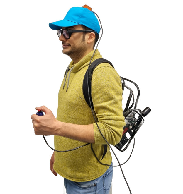
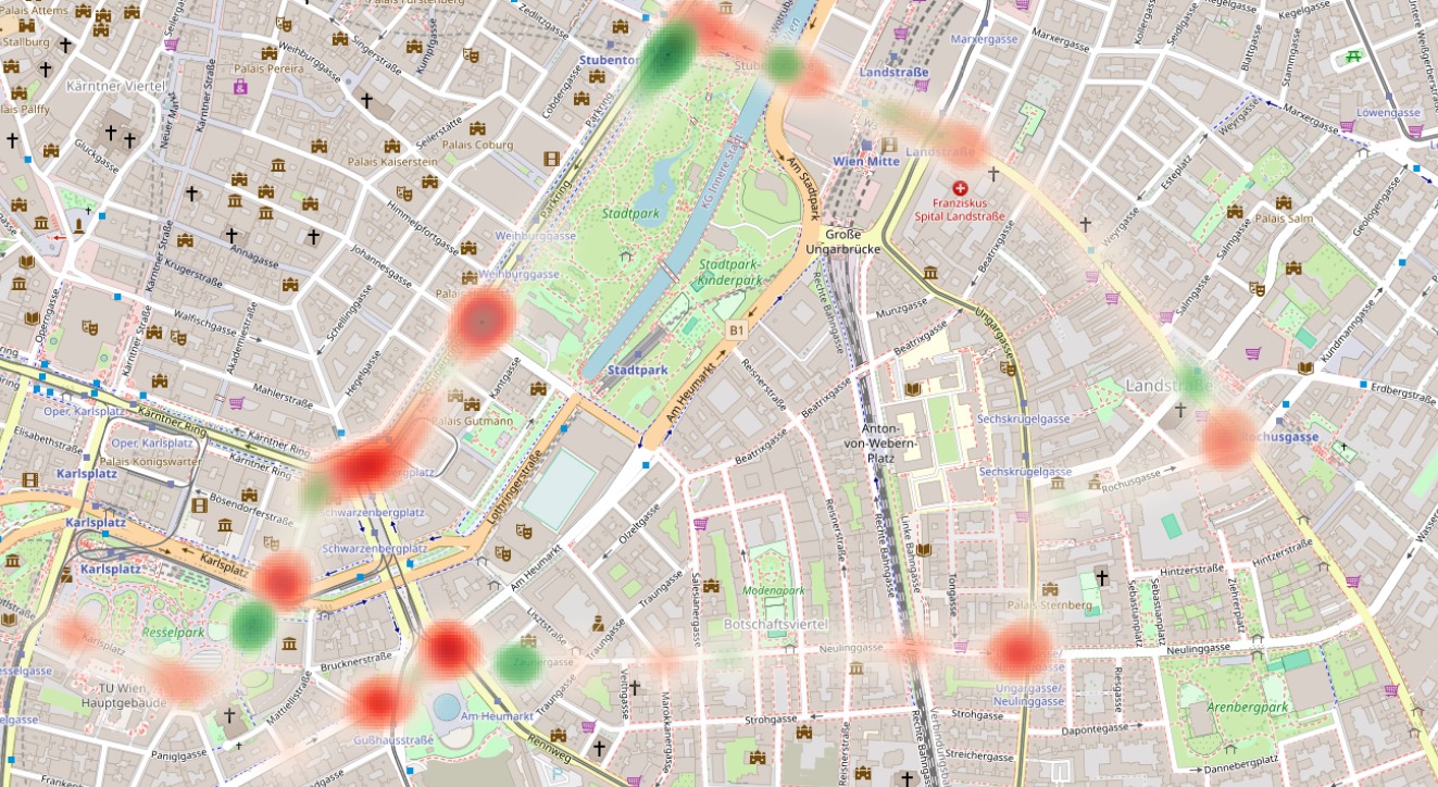
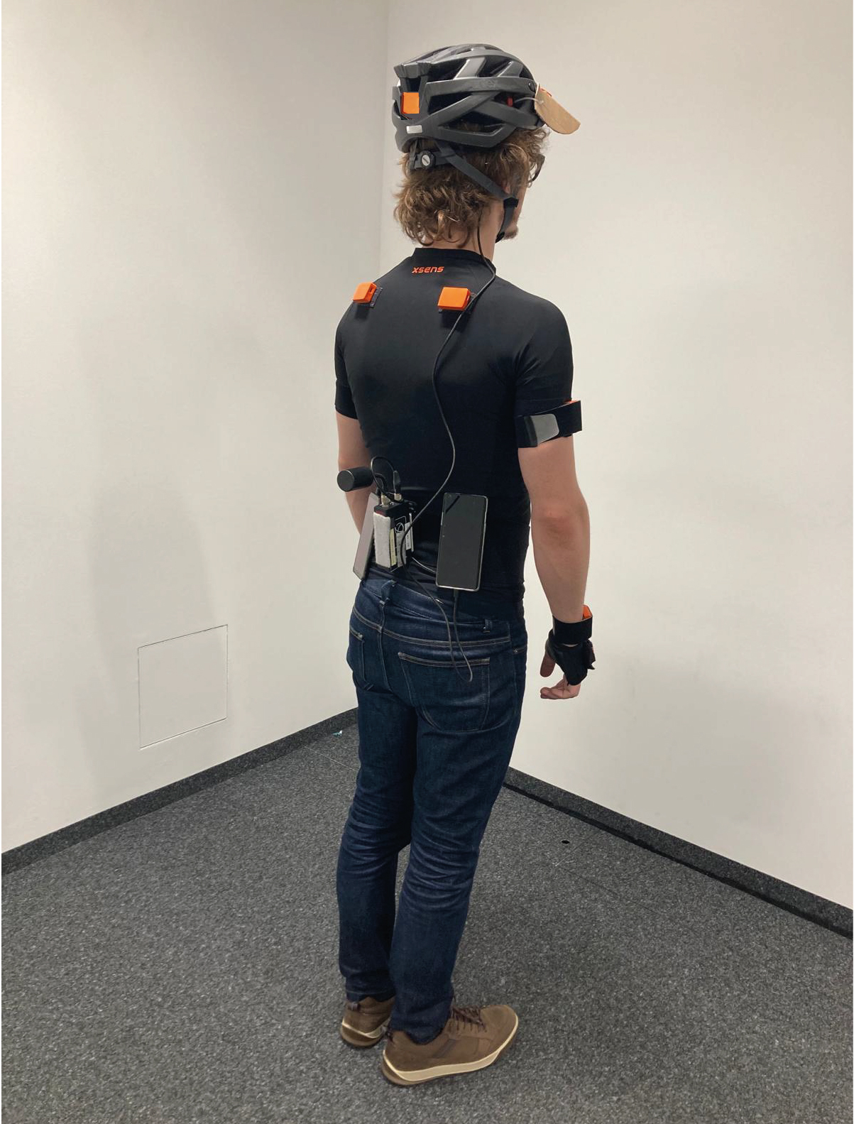
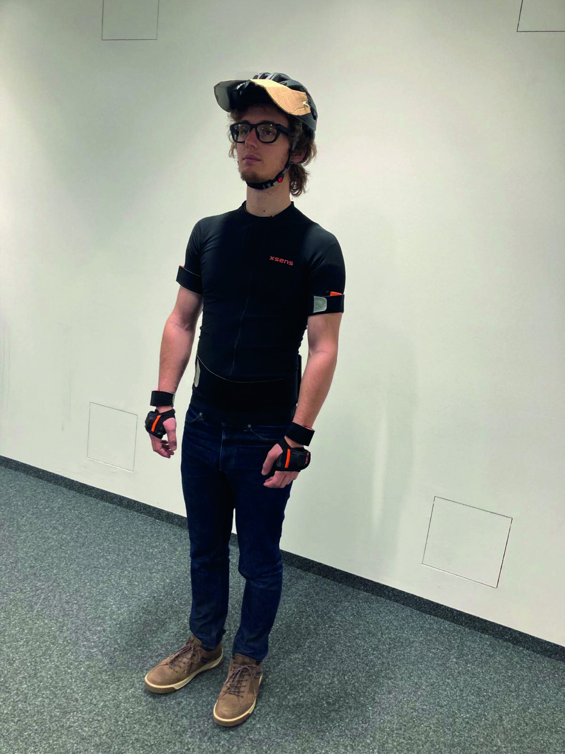
In collaboration with the Spatial HCI Lab, we have conducted several real-world user studies to better understand how people navigate urban environments. Using mobile eye-tracking glasses, head-mounted IMU sensors, and other wearable devices, we collected rich behavioral data from participants walking through the city. With these data, we trained machine learning and deep learning models to predict moments when individuals feel uncertain, disoriented, or likely to make navigation errors. This line of research deepens our understanding of how people perceive their surroundings and how cognitively demanding it can be to walk through complex urban spaces. Cognitive complexity plays a key role in shaping human mobility — and our next step is to extend this research to users of other transport modes. Take a look at our publications so far and stay tuned!
Methods & Tool
MYFix
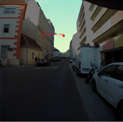
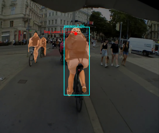
Our automatic fixation annotation and video segmentation pipeline enables us to identify not only all visible cues in a scene but also those that actually capture the attention of pedestrians or riders. This allows us to take our analysis to the level of visual cognition, uncovering how people visually perceive and process their surroundings.
See the MYFix article for more information!
Understanding Perceived Safety of Cyclists
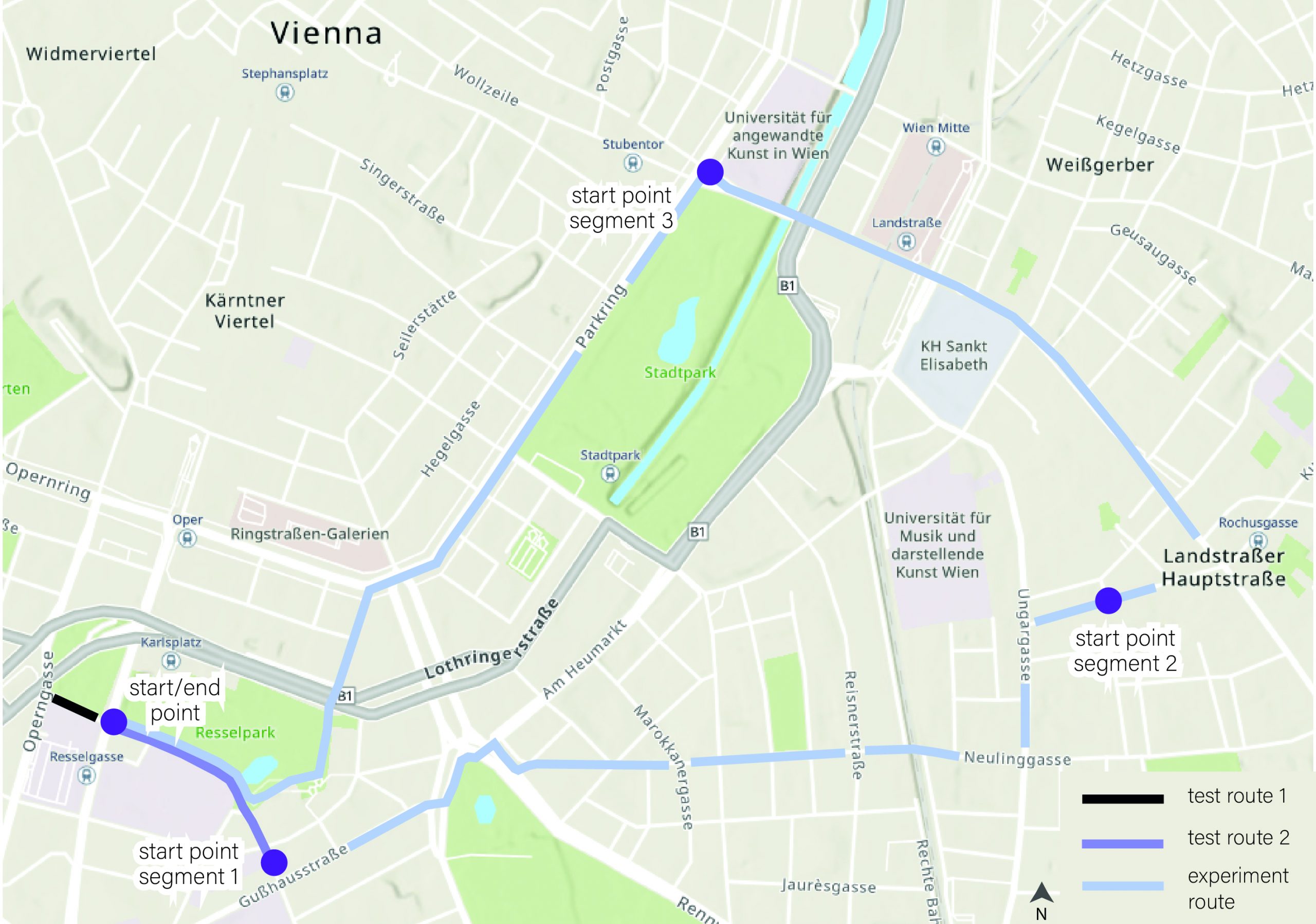
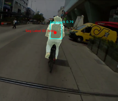


Emotions of Cyclists in Vienna
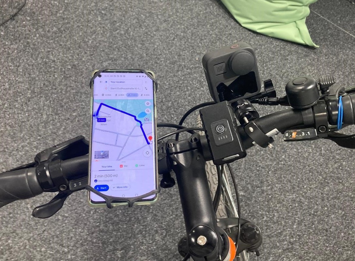
Using a similar set of sensors—this time on bike riders—we aim to understand how movement and gaze behavior relate to positive and negative emotions. In addition, by combining IMU recordings with UrbanCore’s analytical capabilities, we can predict the surface type of cycling routes, a key factor for safety assessment. Our approach, therefore, enables both objective and subjective measurements of safety and emotional experience in urban mobility.
See this master’s thesis done in the Spatial HCI Lab for more information!
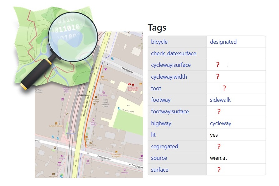
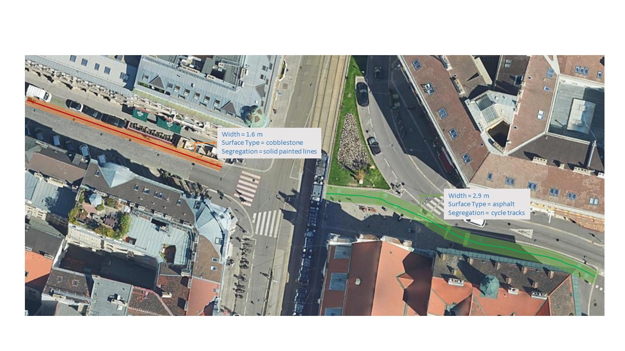
Understanding Objective Aspects of Safety for Cycling Infrastructure
Cycling Infrastructure in Vienna
While the saying “build it and they will come” often holds true for cycling infrastructure, research has shown that how it is “built” plays a crucial role in whether people actually “come”. Objective measures of cycling safety — such as lane width, surface type, coloring, and the level of segregation from car/pedestrian traffic — all significantly influence how secure bike lanes are. As many cities rapidly expand their cycling networks, mapping these newly constructed lanes often lags behind. OpenStreetMap (OSM), despite being a rich open-source platform for geospatial data, remains incomplete when it comes to detailed attributes like the type of segregation from cars and pedestrians (coloring or physical barriers?), surface quality, or even the actual built width of the lanes.
That’s where XMo Lab’s expertise comes in. By utilizing high-resolution satellite and aerial imagery, we employ advanced deep learning models to automatically extract and update this crucial information, thereby bridging the gap in OSM data and enabling an objective assessment of the safety and quality of cycling infrastructure.
One of our master’s students is working on this topic, so stay tuned!