
Policy Sandbox
What if we could evaluate any policy or intervention before it takes effect? Would it truly achieve its intended impact?
The Mobility Oracle makes this possible: each module is fully modular and customizable, allowing analyses to be tailored to specific questions, scenarios, and urban contexts.
At its core, the framework builds on open raw geodata, which feeds into a multimodal transportation graph representing the urban mobility network. Origin-destination pairs define potential travel demands, while human preferences – such as maximum walking distance – inform algorithmic route generation. The resulting routes form the basis for a range of analyses, from estimating modal splits and accessibility to testing policy scenarios and identifying areas for improvement.

PREVIOUS WORK

What if the average waiting time at traffic lights would be increased?
The Impact of Traffic Lights on Modal Split and Route Choice: A use-case in Vienna
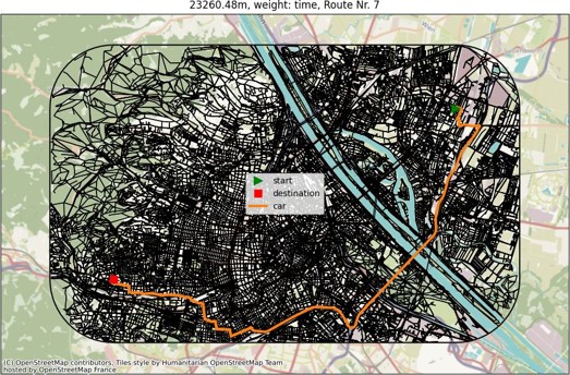
This study examine how varying traffic-signal waiting times influence both modal split (choice of transport mode) and road type selection (primary, secondary etc.) in Vienna. Using a multi-graph of the transportation network and time-optimized routing, the study simulate scenarios in which average waiting penalties at traffic lights are increased (to 60, 90, or even 150 seconds) or decreased (to 10 seconds). The results show that as the delay at traffic lights grows, routes tend to shift away from car use and may reroute through less residential or secondary streets to avoid congestion at traffic lights. This work provides information into how traffic light timing can influence travel routes and provide insights for urban planning and traffic light control strategies.
See the article for more information!

What if all trips go to the city center?

Revealing differences in public transport share through district-wise comparison and relating them to network properties
This previous study explores an in-flow scenario to the city center and reveals, how public transport use varies across city districts and how spatial network properties shape these differences. By analyzing time-optimized trips on a multimodal network, it reveals that public transport shares range from 4.50% to 45.49% depending on district connectivity, highlighting areas where targeted investments could reduce commute times. The findings also show that examining individual transit modes, rather than the network as a whole, provides better insight into how infrastructure influences the modal split.
See the article for more information!
WORK IN PROGRESS
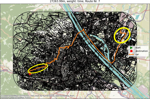
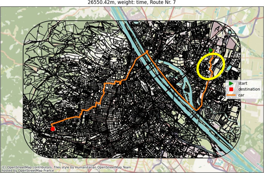
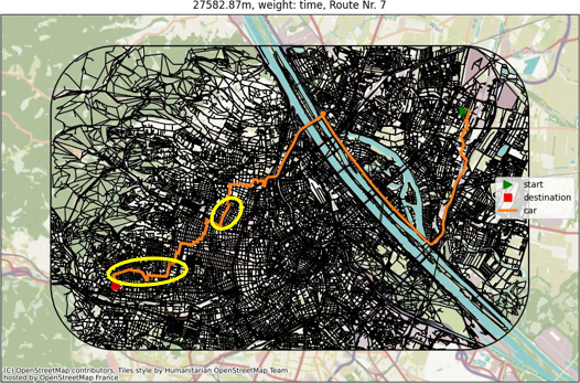
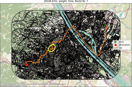
What if Wiedner Hauptstraße is closed for construction?

The Mobility Oracle: A Framework for Approximating Human Mobility (under revision)
How can a construction site affect mobility within a city? Using our framework, we model a specific construction site to analyze how mobility patterns change during the closure period. This approach can be applied to other construction sites or street closures to identify potential “weak points” in the network or areas that require special attention in order to minimize disruption.
What if all one-way streets would be converted to two-way streets?
Should We Convert One-Way to Two-Way Streets? The impact on travelled distance and modal split (work in progress)
Street Network Modifications – such as converting one-way streets into bidirectional streets – explores how changes to urban street layouts could influence travel patterns, trip durations, and the use of different transport modes. Using simulations on both car-only and multimodal networks, the work in progress investigates how network design interacts with mobility choices, providing a framework to test potential interventions for more sustainable urban transport.


What if the car or bike use is restricted for specific users- how would that reshape travel times?

Lost Time in the City: Quantifying Maximum Travel Differences Across Multi-modal Scenarios (work in progress)